|
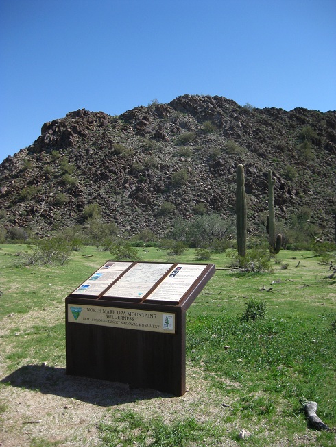
North Maricopa Mountains Wilderness (Gila Bend, AZ)
|
 |
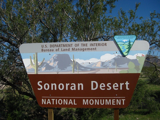
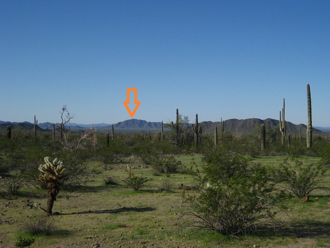
| The Sonoran Desert National Monument to the east of Gila Bend, Arizona, was established by President Clinton literally four days before he left office in 2001. But large portions of the area remained open to grazing and to rampant abuse by the ATV crowd, so I never really felt like visiting. At least until recently, when I read that the BLM had actually closed the North Maricopa Mountains portion of the monument to all motorized travel. Enough incentive for me to go and take a look. | |
|
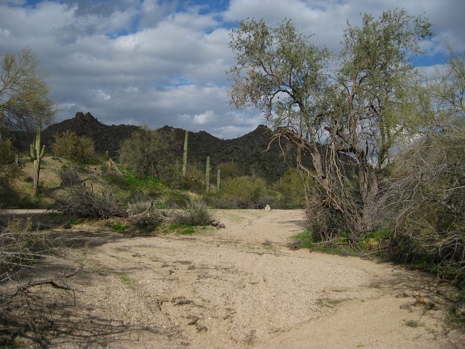
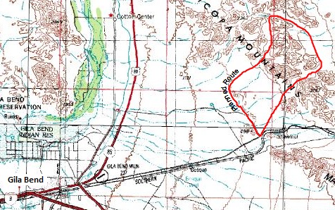
Planning and Preparation For my first visit to the North Maricopa Mountains Wilderness (Sonora Desert National Monument), I opted to follow the two established trails that the monument has to offer. My plan was to hike from AZ 238 (Maricopa Road) cross-country, largely paralleling and following the old jeep road, to the former Brittlebush Trailhead. From there, I would follow the Brittlebush trail until it intersects with the Margies Cove Trail, turn east, circle back around Butterfield Pass, and then to cut across the open expanse of desert to again reach AZ 238 and the car. All in all, my roughly planned route came out at about 16 miles. Adding my "desert hiking is never as straight as it looks on the topo map" safety margin, I guessed the whole loop would be 20 miles or so. Here's an overview map of the planned route, a link to the actually hiked route and waypoints can be found at the bottom of this page. Twenty miles are certainly doable as a day hike, but since early dawn and morning are the hours I enjoy most in any desert, I decided to backpack the loop hike, and to spend the night. Hiking in 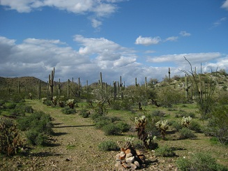 While some of the monument's web pages had proclaimed the OHV closure, other equally official looking BLM web pages had still stated that "4WD was needed" to drive to Brittlebush Trailhead, so I wasn't quite sure what I would find. But as expected and desired, the dirt road off Highway 238 towards Butterfield Trail was indeed fenced and closed, so I happily parked my car in the small patch (CARPARK) next to the Sonoran Desert National Monument sign, and started hiking. For the first mile or so, I simply followed the dirt road, but when I reached the old CORRAL, I left the road and continued straight ahead, to cut off the road's loop via Gap Tank, and to pick up the road again (RD01) right near the wilderness boundary. From there, it was only a short stretch to go until I reached the former Brittlebush Trailhead (OLDPARKING), where a lonely and sunburnt trailhead sign waits to inform the rare hiker. The logbook listed five hikers or hiking parties coming through within the last three months, and this was spring, the prime hiking season in the region! Lots of solitude .. exactly how I like my deserts and hiking.
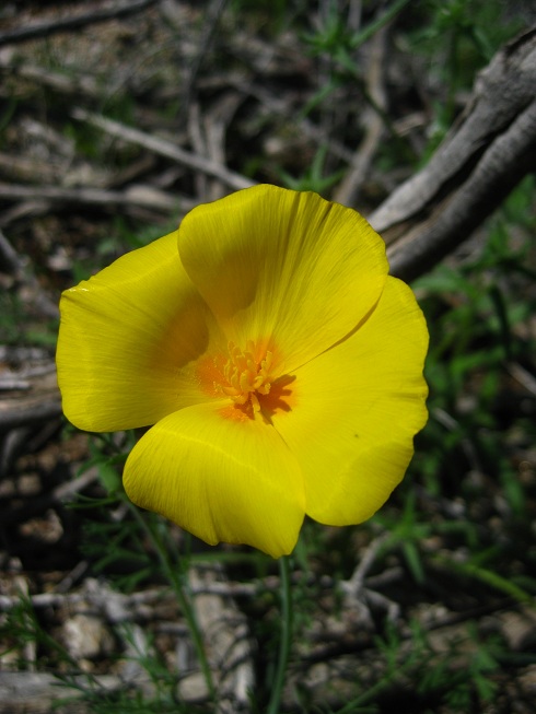
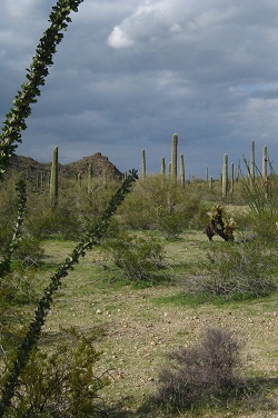
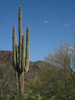 From the trailhead, the trail leads around a little knoll, but then circles back to pick up the old dirt track which starts to veer to the northeast and soon enters what I assume is called Brittlebush Wash (it is unnamed on the USGS topo map of Maricopa Wilderness). Some stretches of the wash bottom are soft sand, but the hiking is still quick and pleasant. Since my hike was in early March and the past few weeks had been quite wet, I wasn't surprised to find a lot of greenery and even tall grass growing in several places near the wash bottom. I had hoped for wildflowers, too, but only got to see a couple dozen solitary Arizona Poppies. The saguaros growing along this stretch are quite spectacular though, there are several grand old and 20+ ft tall specimens right next to the wash. Cholla cactus and Ocotillos are equally abundant, as are ironwood and palo verde trees. A tad further, the wash starts to get narrow and rocky, and the trail climbs out (EXITWASH) to continue along the ridge, before reaching a large CAIRN about a mile later, and then sharply turning to the east to descend into Margie's Cove Wash. This was roughly the halfway point of my hike, and my GPS showed 9.88 miles. In the meantime, somber clouds had started to draw in over the mountain range to the north. Water in a desert only comes in two forms, too little or too much, and since I was hiking in a wash bed, I wasn't sorry to see the clouds dissolve again as quickly as they had appeared.
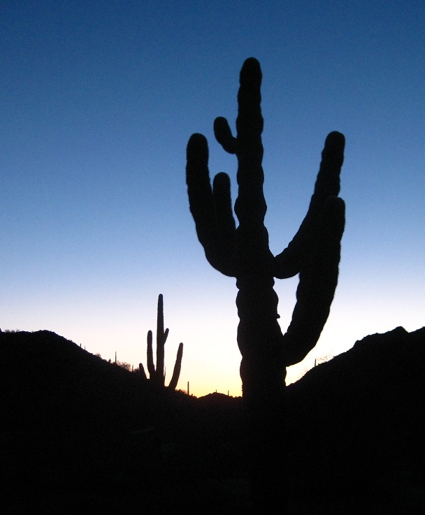
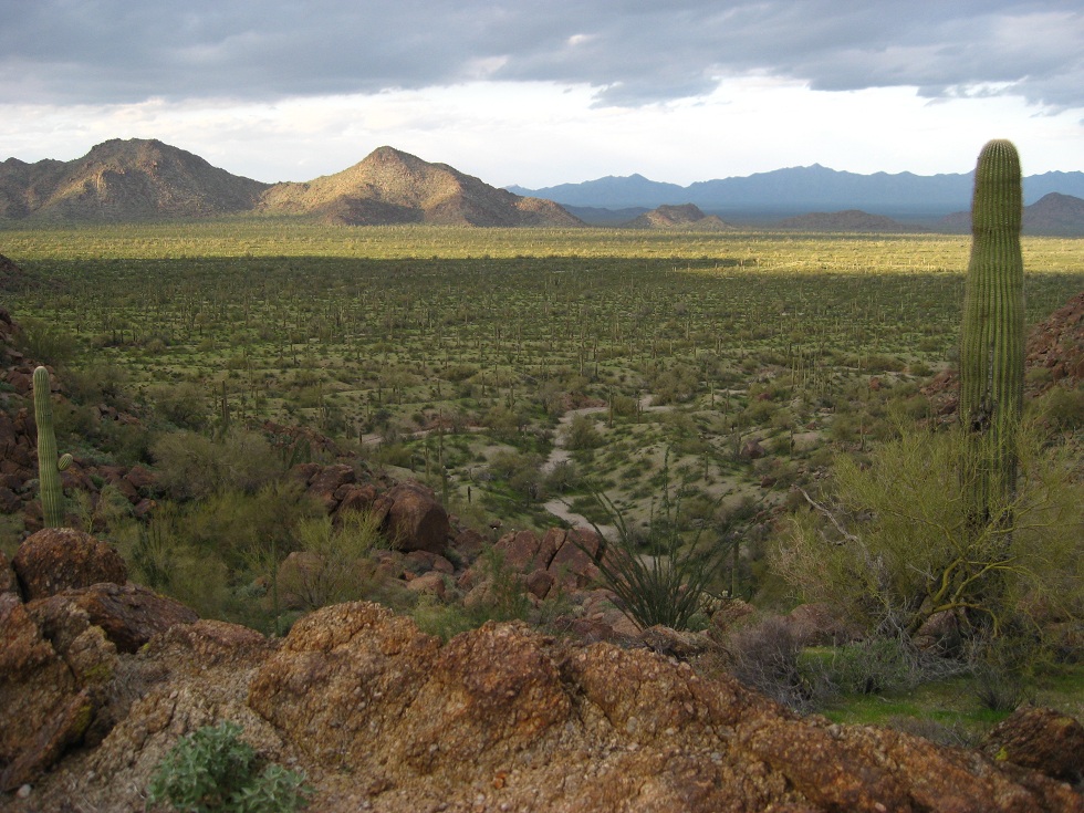
The trail heads upstream, and is well marked with cairns even in the wash bed where no such markers would be necessary. The wash soon peters out, and the trail continues a gentle incline up to the HUMP, at 1975ft the highest point of the hike. Beautiful views await, the plains to the east are studded with saguaro cacti growing as tightly together as I've ever seen them. From here on, the trail loosely follows a wash heading east, descending to an old rusty FENCE and onwards to a dilapidated dirt road (RD02). I believe that this is where old maps of the Monument show "Margie's Cove East Trailhead", but I didn't see any parking or trailhead sign. What I did find though is an enclosed fenced off space with a large sloped concrete patch inside. I had never seen such a contraption before, and it took me a while to figure out that the concrete patch was basically a funnel used to collect rainwater and make it run into a roofed concrete water tank nearby. A nearby "warning" sign explained that this was "Game Water". Needless to say that I didn't take any of the water, but in a true emergency, GAMEWATER1 is one of the very few locations in the wilderness where a dehydrated hiker might have a small chance to find a wet spot even during dry season. Hiking in the desert, I'm constantly on the lookout for signs of water and water itself, but even though I was hiking in a comparably cool and wet early March, I only found two natural water sources on the entire hike. Both were puddles holding about one gallon, in the shade of a canyon and along a stretch of apparently non-porous rock. I have no doubt that during the heat of summer these puddles dry up within minutes after a downpour. In other words, if you go hiking in North Maricopa Wilderness, carry all the water you need to hike back to Hwy 238 or Hwy 85, no matter what happens. 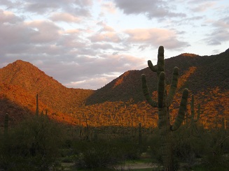 By the time I got to the Game Water site, it was about 4:30. Too late to hike far, too soon to set up camp. I was also getting a bit miffed at the fact that the trail so far had led me mostly around all the Maricopa Mountains, and not actually up into the rocks a little. Given that I anyway had to hike a quarter mile away from the water as is customary to avoid spooking thirsty wildlife, I opted not to hike around the hills to the road through Butterfield Pass as planned, but rather to aim straight for the hills to the south, and go over what looked like a saddle between the peaks. Half an hour later, I was huffing and puffing up a sharp-edged yet crumbly rock slope to the top of the pass, from where I had a superb view back down into the valley that I had just left. (Double-click on Valley View in the attached Google Earth track to be taken to the same spot and view angle). Descending on the far side turned out to be slow going, because of several large boulders wedged into the narrow wash that I had to climb around. But luckily these mountains ain't high and these valleys ain't deep .. so after only about 15 minutes of climbing around rocks, I reached the bajada below. The wind had picked up again by then, and it turned out that it wasn't easy at all to find a level spot for my tent that was not within "striking distance" of a potentially toppling saguaro nearby. Since I didn't have any intention to make the news headlines as the first camper found buried in his tent by a saguaro, I kept looking until I found the perfect spot. It is NOT the spot marked by "TENT" on the GPS data, I fudged that one a little ... go find your own camp site :-).
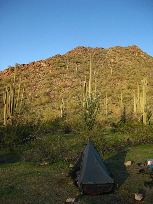
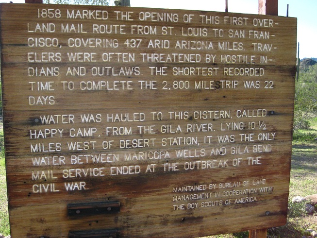
Night and Morning The night got cold ... really cold, my guess is close to freezing, but since I had brought both my REI 25F sleeping bag and my A+mazing Exped Synmat, I didn't mind the temperature one bit and slept serenely until way too early, when a cactus wren nearby started its ratchety bird"song" to complain about something. The dawn was only just breaking over Butterfield Pass to the east. I should have known better, but got up out of the warm sleeping bag way too soon, and then spent half a hour shivering, until the sun finally deigned to pop over the ridge and let her rays reach my camp site. After thawing my fingers enough to strike a match, I cooked a mug of oatmeal on my hobo stove, and welcomed the desert morning that I so cherish. 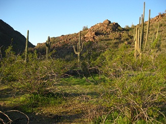 Once the tent and sleeping bag were stowed again into my backpack, it was only a short hike down the wash until I reached the dirt track of the former Butterfield Stage Route and Juan Bautista De Anza National Historic Trail (RD03). This stretch used to be prime ATV real estate until the road was closed, so I wasn't surprised to find several wheeled tracks veering back and forth through the shrubs. Near the old Butterfield Campsite, there is also quite a bit of broken bottles & co .. just the kind of debris you expect to find in a place that is reachable by car. I'm not saying that all ATVers litter, or that backpackers don't litter, but my empirical evidence after years of hiking suggests that there are far less moronic backpackers on the planet than there are moronic Jeepsters. A tad further, there is another Game Water contraption (GAMEWATER2), similar to the one on the far side of the ridge that I had encountered earlier. It also contained water, full of algae and wibbling creatures, but I still had an ample supply of water in my backpack anyway. From there, it is a short stretch along the road to "Fourtymile Desert Tank" (DESERTSTATION), a former way station along the stage route. There isn't much left besides a pile of rocks and a sign or two.
 Now, if it had been late on day one, and I had wanted to do this loop as a day hike .. I would simply have followed the road all the way back to the CORRAL and then to the car. But since it was bright and early, and I felt like exploring and marveling more than like hiking, I decided to go cross-country and make a bee-line to the car. Doing so would lead me along and across more washes and - as I hoped - interesting vegetation and features than I would get to see when following the road. Heading from DESERTSTATION to CARPARK is easy, there is a convenient prominent ridge on the horizon that you can aim for and that allows to hike ahead without constantly checking the GPS. The stretch about half a mile from Hwy 238 is again pretty trashed by ATV tracks, but in between, there are several small washes, pristine, studded with cacti, wildflowers and budding creosote bushes. Around 9:30, I got back to the car, and the full loop turned out to be 19.82 miles. After a big gulp form the Gatorade bottle that I had left in the car and after a quick change of shirt and socks, I was ready for a second breakfast. Two cups of coffee and "Huevos con Chorizo" at the Space Age Diner in Gila Bend were exactly what I needed! A Google Earth KMZ trackpoint file is available for this hike. The words in UPPERCASE on this page refer to GPS waypoints in the track log. © 2010 Daniel Wesemann (back to travel overview) |
|